City records convey data, instructions, or information, generally without embellishment. But there are exceptions, and this Find of the Week is an outstanding example.

Topographical Maps in the Matter of Opening Central Park, New York, July 1855, Title Page. NYC Municipal Archives.
The image depicted is the title page of a ledger “Topographical Maps in the Matter of Opening Central Park, New York, July 1855.” Created by City surveyor Roswell Graves, the ledger contains 40 plates depicting the topographical features of the land that would become Central Park.

Topographical Maps in the Matter of Opening Central Park, New York, July 1855, sample plate. NYC Municipal Archives.
Beginning in 1807, surveyor John Randel, Jr., produced a map for the Commissioners Plan of 1811, which imposed a grid of streets and avenues creating uniform blocks from Houston Street north to 155th Street. By the time Graves surveyed the land for Central Park, the blocks had been divided into lots to facilitate development. Each plate of the Graves ledger displays three blocks in what would become the park—from 59th to 106th Streets, between Fifth and Eighth Avenues.
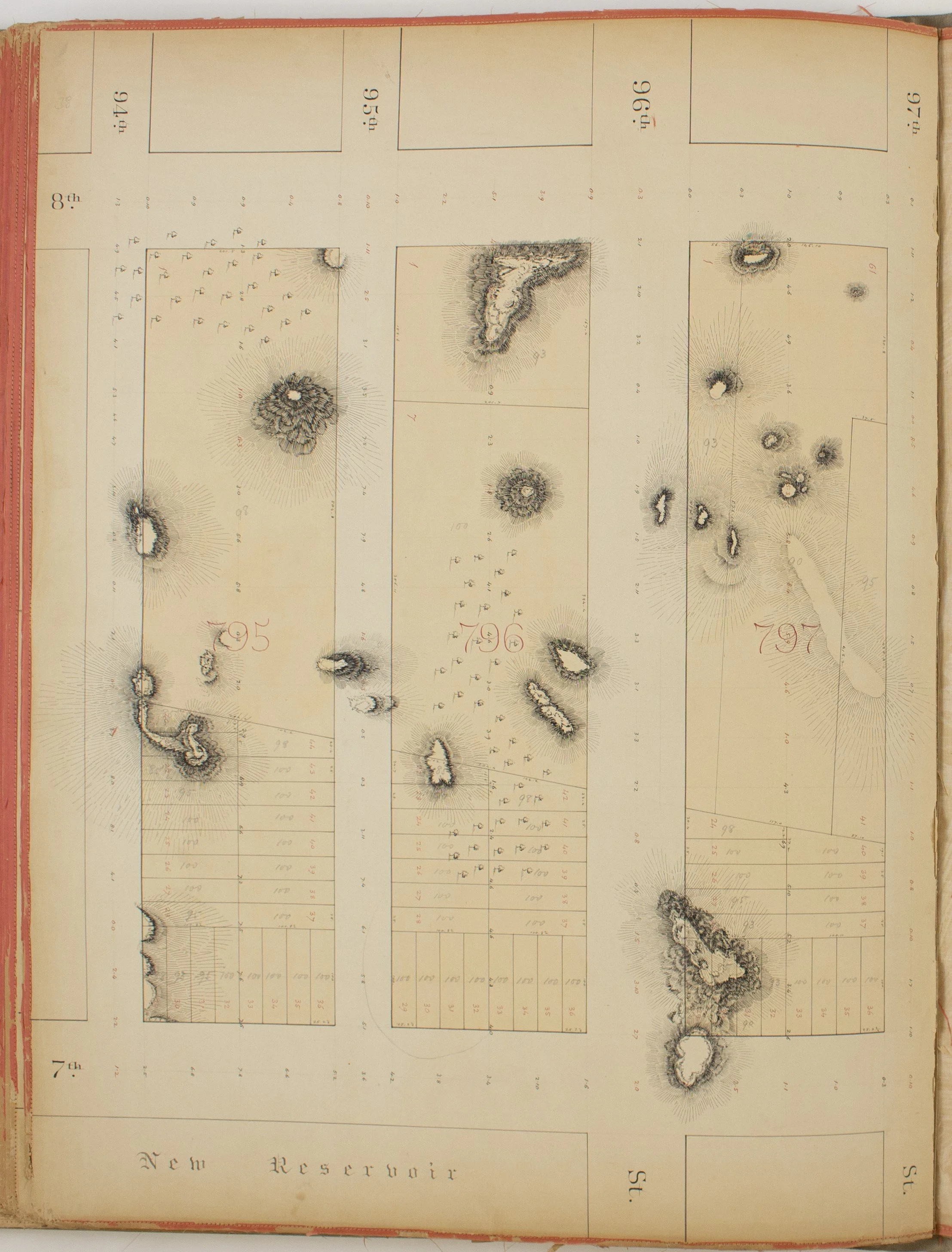
Topographical Maps in the Matter of Opening Central Park, New York, July 1855, sample plate. NYC Municipal Archives.
The ledger is currently being appraised in the Conservation Laboratory to determine treatment and re-housing measures that will ensure its long-term preservation. Look for future articles for updates and information about the provenance of this significant item.
This Find of the Week is apropos of the upcoming annual Earth Day celebration (April 22), given that it pertains to one of the more popular places on earth – New York’s Central Park.