Stables and Auction Marts - Building Plans with Horses

A recent For the Record article, Horsepower the City and the Horse introduced the topic of the horse and its profound influence on virtually all aspects of city life. Expanding on this theme, For the Record looked at how the horse informed many of the design elements of Central Park in Drives Rides and Walks -Horses in Central Park.

This week’s post continues exploring the subject of horses and focuses on collections in the Municipal Archives and Municipal Library that document structures built in the city to house, buy and sell horses. 

Fiss, Doerr & Carroll Horse Auction Market, front elevation. Located at 147-51 East 24th Street and 144-148 East 25th Street between Lexington and Third Avenues the auction market was designed by Horgan & Slattery in the grandest style. The building mixed Roman classicism and Beaux-Arts grandeur, with a façade that featured a full-size sculpture of a horse and trainer above the entrance. Manhattan Building Plans Collection, Block 880, Lot 34. NYC Municipal Archives.

The former Fiss, Doerr & Carroll Horse Auction Market, 1940. Tax Photo Collection. NYC Municipal Archives.

Fiss, Doerr & Carroll Horse Auction Market, detail. While the market still had the required utilitarian aspects with stalls and manure pits, it was fitted with elaborate chandeliers and ornate decoration which led Architects’ & Builders’ Magazine to write that Horgan & Slattery had decided '“to abandon all former conventions” in its design. In 1928, the auction mart was sold to the R&T Garage Company, which installed two intermediate floors for parking and removed the balcony and ornate ceiling. Manhattan Building Plans Collection, Block 880, Lot 34. NYC Municipal Archives.

The Landmarks Preservation Commission Designation report for the VanTassel and Kearney Auction Mart, located between East 12th and 13th Streets, Manhattan, one of few horse-related buildings still standing (although long-since re-purposed), provides some context: “A century ago, the streets of American cities were crowded with horses. Mainly used for transportation, these animals pulled private carriages, stage coaches, and streetcars. To accommodate the estimated 75,000 horses in New York City, about 4,500 stables were built. Wealthy families commissioned their own distinctive structures where horses, carriages, and attendants (grooms and coachmen) were quartered.” 

The Manhattan Building Plans collection and the related permit files in Municipal Archives are a rich resource documenting horse-related infrastructure. For the last several years, City archivists have been processing the Plans collection with support from the New York State Archives’ Local Government Records Management Improvement Fund and the New York State Library’s Conservation/Preservation Program. For the Record blogs, most recently Loews Canal Street Theater, have tracked progress and highlighted some of the exceptional items discovered during processing. The agency’s Lunch and Learn programs, available online, provide an overview of the project.

Fiss, Doerr & Carroll Horse Auction Market, second story plan. The auction space enclosed a huge interior rink 65 feet by 197 feet, where animals for sale were exercised for crowds of up to 1,000 people in a suspended gallery. The roof was supported by a steel arch, with a suspended, coffered ceiling and the mezzanine level included office and living quarters for the staff. Manhattan Building Plans Collection, Block 880, Lot 34. NYC Municipal Archives

Horse auction venues, much like auto dealerships in later years, were an essential component of the horse culture in the city. Several of the most visually appealing items in the Plans collection are the blueprints submitted to the Department of Buildings in 1906 by architects Horgan & Slattery for construction of the Fiss, Doerr & Carroll horse auction market at located at 147-51 East 24th Street and 144-48 East 25th Street. Although no longer extant, the elevations and details depict what had been an elegant chandelier-lit space.

Front elevation and longitudinal section, submitted with application 1568 of 1899 by architects Schneider & Herter for stables and auction market at 49 Orchard Street. The facade of the building was decorated with sculptural elements including a horse head detail. The longitudinal section depicts the ramps used to move the horses from one floor to the next as well as a horse wash and a hoist system for the animals. The building was converted to a storefront and tenement units by 1927 with the ornamentation removed and windows changed. Manhattan Building Plans Collection, Block 308,Lot 23. NYC Municipal Archives.

The collection also includes plans submitted in 1903 by architects Jardine Kent & Jardine for the Van Tassel and Kearney Auction Mart. As noted above, the building has been designated by the Landmarks Preservation Commission for its significance. “In terms of architectural design and specialized purpose, the former Van Tassell & Kearney auction mart recalls the era when New York City was a leading auction center and horse sales were a common activity.” Information in the designation report (available in the Municipal Library), adds considerably to the history of the building: “Edward W. Kearney, son of the firm’s founder, commissioned this elegant building to attract the type of wealthy clientele that purchased horses for competition and leisure. Weekly auctions took place in the ‘commodious sales ring,’ a shed-like space with mezzanine. Van Tassell & Kearney were active on East 13th Street for more than fifty years. Originally general auctioneers, after 1904 ‘high class’ show horses and ponies dominated sales. By the 1920s, the firm was mainly involved in automobile sales and the building would be leased to a candy manufacturer, and later, the Delehanty Institute, a vocational school that trained women for the defense industry during the Second World War. In 1978, the structure was acquired by the painter, printmaker and sculptor Frank Stella, who used it as his studio until 2005.”

Elevation and section, from New Building Application 323 of 1903, by Jardine Kent & Jardine for the Van Tassel & Kearney stables, 126-128 East 13th Street and 123 East 12th Street. Manhattan Building Plans Collection, Block 558, Lot 43. NYC Municipal Archives.

126-128 East 13th Street, former Van Tassel & Kearney stables, ca. 1985 when it was Frank Stella’s studio. 1980s Tax Photograph Collection, Block 558, Lot 43. NYC Municipal Archives.

Eldridge Street elevation submitted with New Building Application 1656 of 1887 for stables. Owner: Edward and Ridley & Sons Department Store, 59-63 Allen Street and 88 Eldridge Street. Manhattan Building Plans Collection, Block 307, Lot 24. NYC Municipal Archives.

Not all of the horse-related structures were as grand as the auction houses.  Perhaps more typical of the genre is the blacksmith shop at 33 Cornelia Street in the Greenwich Village neighborhood of Manhattan. The related Manhattan Building Permits collection provides good documentation for this modest building, The permit folder includes the new building application (no. 331) submitted on July 3, 1913, by architect Nicholas Serracino on behalf of building owner Mary P. Brescianni. Additional applications in the permit folder trace the subsequent history of the building. An Alteration Application filed on December 15, 1954 requested conversion of the space into a “grocery, fruit & vegetable store” 

Similarly, the permit folder for the stables constructed at 59 Allen Street (B. 307, Lot 24) help trace the evolution of the building. The folder contains new building application no. 1646 of 1887 submitted by Edward Ridley and Sons for a “stable & wagon house” designed by architect William Shears. In 1916, according to alteration application 3284, “It is proposed to use the first, second and third floors for garage purposes.” Conversion to automobile storage proved a popular re-use for stable structures in the early part of the twentieth century.

The Village blacksmith 33 Cornelia Street, Manhattan, August 6, 1937. Photographer: E.M. Bofinger. WPA Federal Writers’ Project Photograph Collection. NYC Municipal Archives.

Other useful resources can be found in the Municipal Library’s collection of published materials. The 1866 [Manhattan] Bureau of Buildings Annual Report indicates that builders submitted 131 applications for stable construction, out of a total of 1,507 new building permit requests. In 1900, after the City’s consolidation when the Bureau’s activities covered construction in all five Boroughs, the report listed 199 stable applications (out of more than 6,000 structures in total). Ten years later, that number diminished to 59 applications out of 778 in total. In the next year, 1911, with automobiles increasingly present in the city, the Annual Report recorded 64 plans filed for “Stables and Garages,” out of 771 total applications. By 1935, the category recorded only “Garage” applications; 17 in that Great Depression year (out of 98 total).

New Building Application 1056 of 1887, page 1 of 2. Manhattan Building Permits Collection, Block 307, Lot 24. NYC Municipal Archives.

New Building Application 1056 of 1887, page 1 of 2. Manhattan Building Permits Collection, Block 307, Lot 24. NYC Municipal Archives.

The New York City Guide, published by the Works Progress Administration in 1939 (the manuscript and research for the Guide can be found in the Archives collection; the printed book is available in the Library), has a brief narrative in the section about the Middle and Upper East Side of Manhattan, describing Twenty-fourth Street, between Second and Lexington Avenues as “Old Stable Row.” According to the Guide, “Here, before the advent of the automobile, a horse mart flourished.” The text continued: “The street was littered with straw, oats, and manure. On auction days, the strength of draft horses was demonstrated by hitching the animals to wagons with locked wheels and then whipping them up the block and back.”

The apparent cruelty of this practice points to other important themes related to horses in the city that future For the Record articles will explore using records available in the Archives and Library.

Front elevation and longitudinal section, detail, submitted with application 1568 of 1899 by architects Schneider & Herter for stables and auction market at 49 Orchard Street. Manhattan Building Plans Collection, Block 308,Lot 23. NYC Municipal Archives.

Radio Row and the Fight for Lower Manhattan

It has been said that nobody loved the Twin Towers until they were gone, and that is certainly true of the residents and business owners of the Manhattan neighborhood known as Radio Row. One of many such “Radio Rows” in cities throughout America, New York City’s was the largest and one of the oldest. It was roughly bounded by Dey Street to the north, Liberty to the south, between West and Church Streets. The heart of it was Cortlandt and Greenwich Streets, but another concentration of shops lined Dey Street (also known as Telegram Square for the Western Union Building at the corner of Broadway and Dey). At its peak over 400 merchants sold radios, televisions, and associated parts in this area.

DaVega City Radio, 63 Cortlandt Street, ca. 1939. Tax Photograph Collection, NYC Municipal Archives.

North-Star Radio, 78-80 Cortlandt Street, ca. 1939. Tax Photograph Collection, NYC Municipal Archives.

From the earliest days of radio in the 1920s, dealers in radios and radio parts set up shop in the area. As car radios became more common, some shops specialized in conversion kits for autos. Other shops just sold vacuum tubes, which frequently burned out and were often non-standard parts hard to find.

By the time the New York City Department of Finance Tax Photo project got underway in the late 1930s, the area was bustling with vendors and buyers. A famous 1936 WPA Federal Writers’ Project photograph shows a crowd of men standing along Cortlandt Street in front of DaVega City Radio listening to a World Series game between the then New York Giants and the Yankees. A second photo reveals why they are all looking across the street: two men hanging out the window of Atlas Radio updating a scoreboard. The neighborhood was not just about radios, as revealed in the Tax Photos: bicycle shops, bars, coffee shops, diners, hotels, pet shops and automotive stores also were packed into the old brick buildings. A few newer buildings housed insurance companies. In the 1950s, televisions became popular, and Radio Row vendors started to sell them, and their components, as well.

Men watching World Series announcement board, Cortlandt Street (Radio Row), 1936. WPA Federal Writers' Project collection, NYC Municipal Archives.

The World Series announcement board above Atlas Radio, which the men on Cortlandt Street were watching, 1936. WPA Federal Writers' Project collection, NYC Municipal Archives.

Bell Radio, 60 Cortlandt Street, ca. 1939. Tax Photograph Collection, NYC Municipal Archives.

Weston Radio, 64 Cortlandt Street, also Times and Publix Radio, ca. 1939. Tax Photograph Collection, NYC Municipal Archives.

Vim Radio, 70 Cortlandt Street, ca. 1939. Tax Photograph Collection, NYC Municipal Archives.

Arrow Radio, 82 Cortlandt Street, ca. 1939. Tax Photograph Collection, NYC Municipal Archives.

Detail of a 1934 GW Bromley atlas of Manhattan showing the area where Radio Row existed. Everything from Liberty to Vesey Street, from Church to the river was demolished for the World Trade Center in 1966 and 1967. NYC Municipal Archives.

It was a successful business district, even if a bit unsightly, but by the 1960s Lower Manhattan was slated for a dramatic change. The waterfront businesses essential to a port city were no longer needed, as a new era of trucking and the introduction of the cargo container took hold. In addition, airplane travel reduced the number of passenger ships coming into the Manhattan docks. David Rockefeller, Chairman of Chase Manhattan Bank (and brother of Governor Nelson Rockefeller), envisioned a World Trade Center that could revitalize Lower Manhattan. He had already used political pressure and eminent domain to build One Chase Plaza in 1956 on the site of the old sail-making lofts of the Coenties Slip area near the Financial District. He thought the area just north, South Street Seaport, would be the perfect site for his World Trade Center. He created the Downtown-Lower Manhattan Association (DLMA) to remake Lower Manhattan. To bring in more financing, he approached the Port Authority of New York and New Jersey, an interstate compact created in 1921. However, New Jersey Governor Robert Meyner saw nothing in the project for New Jersey. Eventually, New York Governor Nelson Rockefeller struck a deal that would move the project to the west side if the Port Authority would take over the bankrupt Hudson & Manhattan Railroad and build the new World Trade Center on top of its southern terminal, creating the PATH train system. The plan also called for the Port Authority to destroy the freight piers along West Street and build container ports at the Port of Newark-Elizabeth, New Jersey.

Letter from the Downtown-Lower Manhattan Association to Mayor Lindsey, February 1966. Mayor Lindsey Collection, NYC Municipal Archives.
Letter from Mayor Lindsey to David Rockefeller, August 1966. Mayor Lindsey Collection, NYC Municipal Archives.
Emergency Committee to Oppose the World Trade Center letter, November 1966. Mayor Lindsey Collection, NYC Municipal Archives. The Committee was made up of prominent journalists, historians, and architectural critics, including Jane Jacobs, fresh from her fight against Robert Moses’ Lower Manhattan Expressway.
Telegram from Thomas Maguire, Vice President International Union of Operating Engineers to Mayor Lindsey, urging him to press forward with the Trade Center, March 1967. Mayor Lindsey Collection, NYC Municipal Archives.

The radio-shop owners had initially been fans of the proposed east-side trade center, which they thought would bring in new business. However, when they saw plans for the west side and realized the proposed site would completely wipe out their business district, they formed the Downtown West Businessmen’s Association and started to advocate against the project. Headquartered at Oscar’s [Nadel] Radio Shop at 63 Cortlandt Street (formerly DaVega City Radio) they fought the plan through protests, legal challenges, and street theater. They were joined by other groups, including the Committee for A Reasonable World Trade Center (made up of prominent real-estate families), and the Emergency Committee to Oppose the World Trade Center, a more literary and artsy group, which had amongst its members Jane Jacobs. Mayor Lindsey’s subject files contain a thick folder from 1966-1967 with correspondence on the World Trade Center from and to these groups. Also represented are commerce and labor groups that strongly advocated for the project to fight the economic slump in the building trades.

Letter from the Downtown West Businessman’s Association, February 1966. Mayor Lindsey Collection, NYC Municipal Archives.

Letter from the Downtown West Businessman’s Association, February 1966. Mayor Lindsey Collection, NYC Municipal Archives.
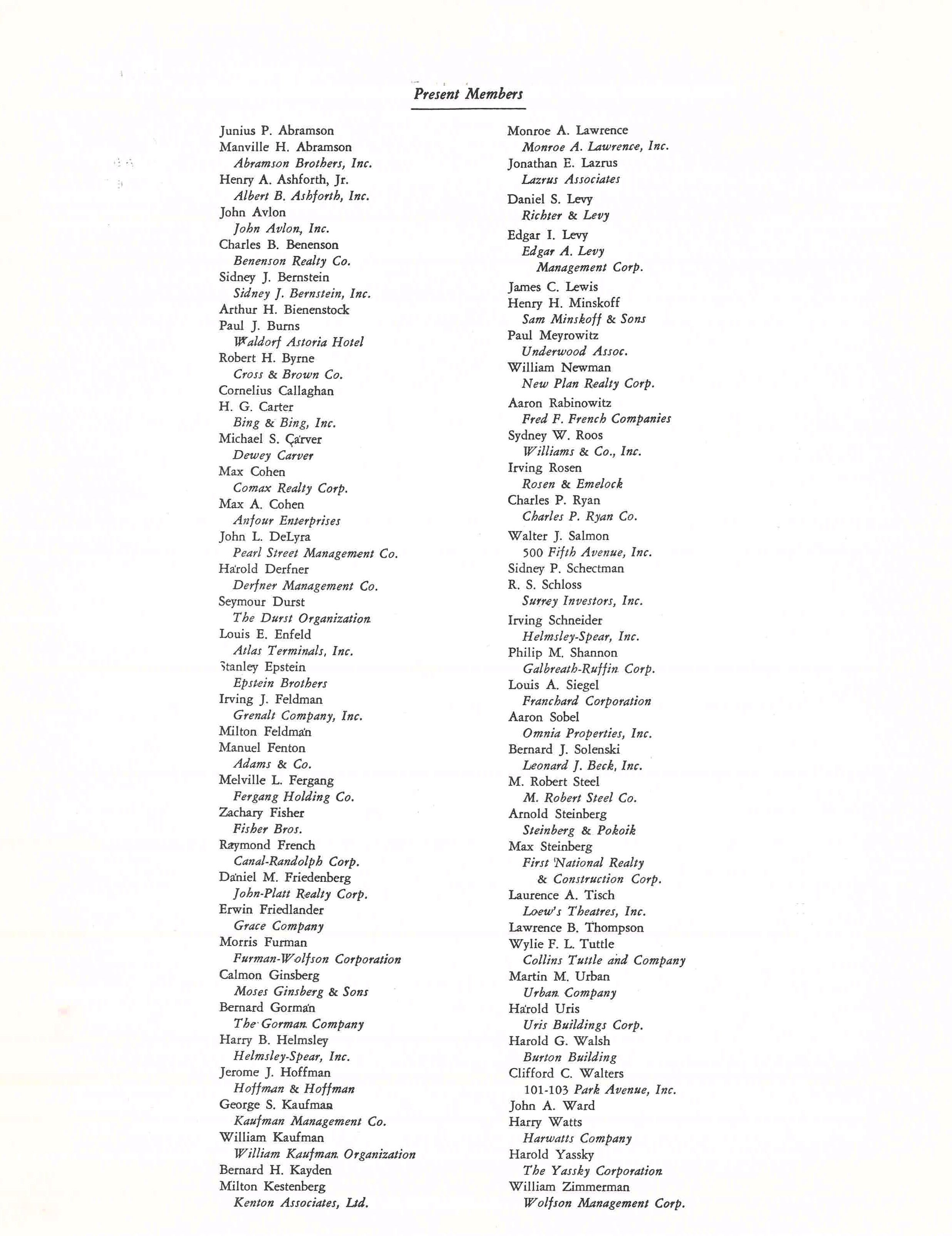
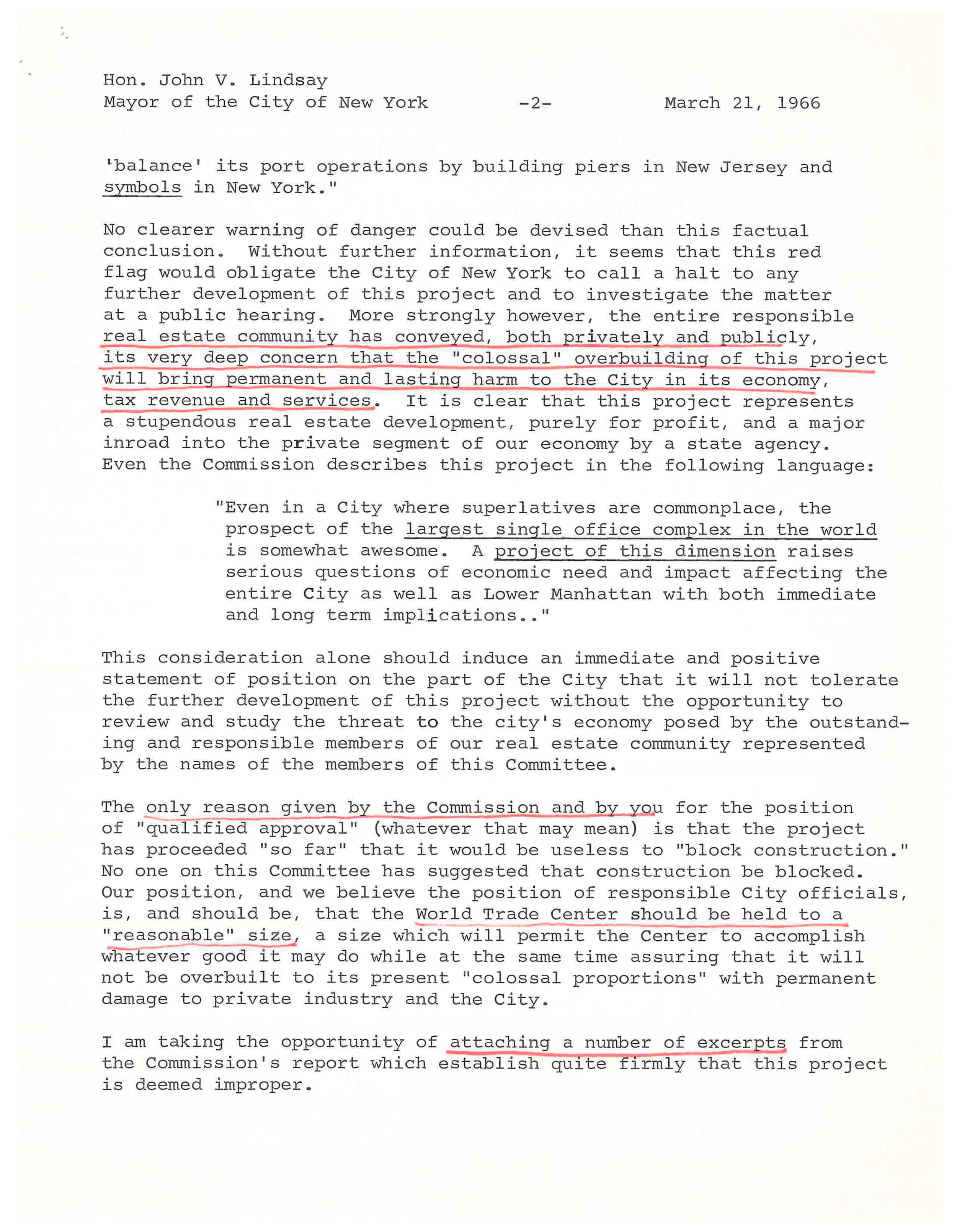
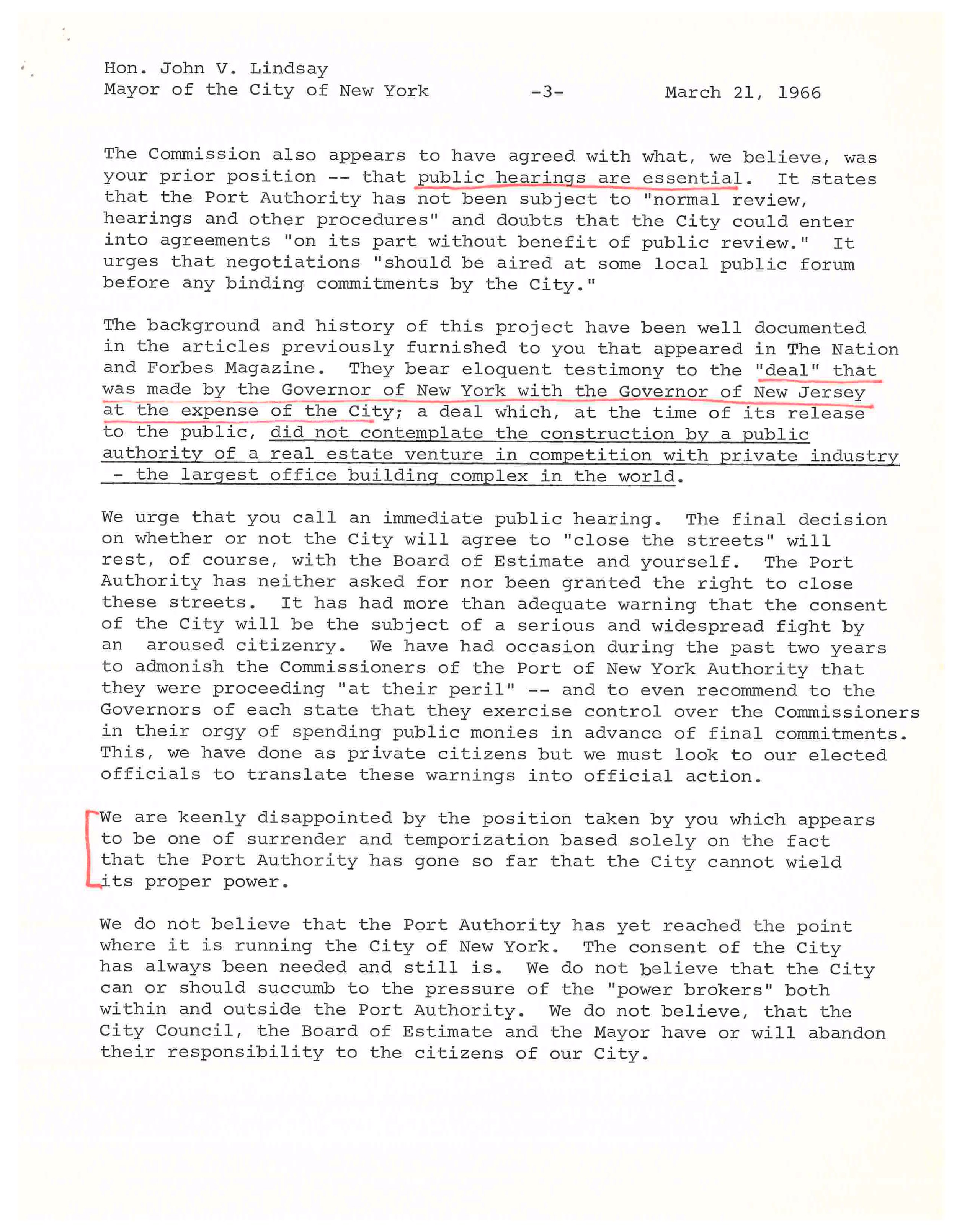
Letter from the Committee for a Reasonable World Trade Center, March 1966. Mayor Lindsey Collection, NYC Municipal Archives. This committee represented prominent real-estate interests, who feared the new trade center would devalue commercial real estate in the City.

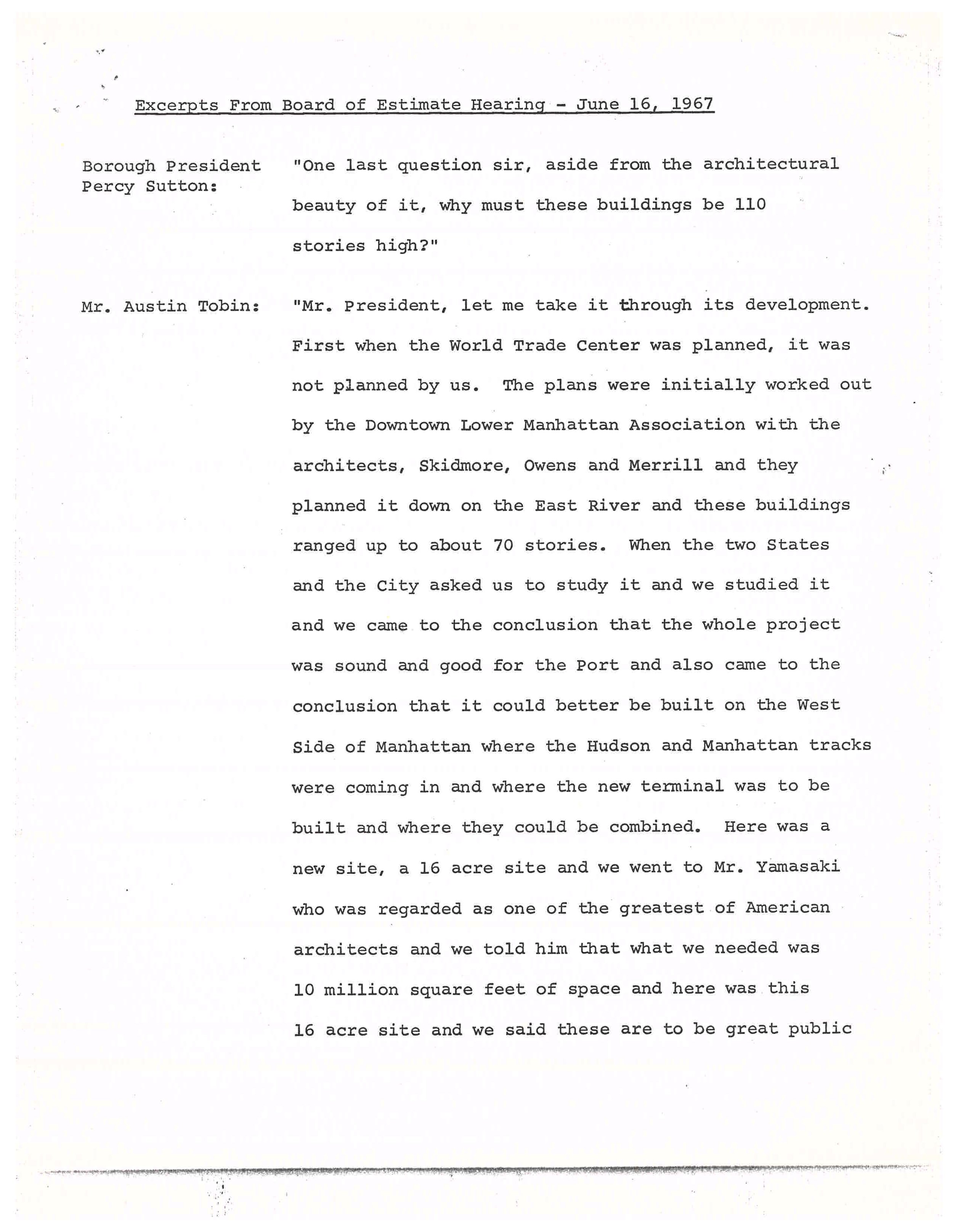
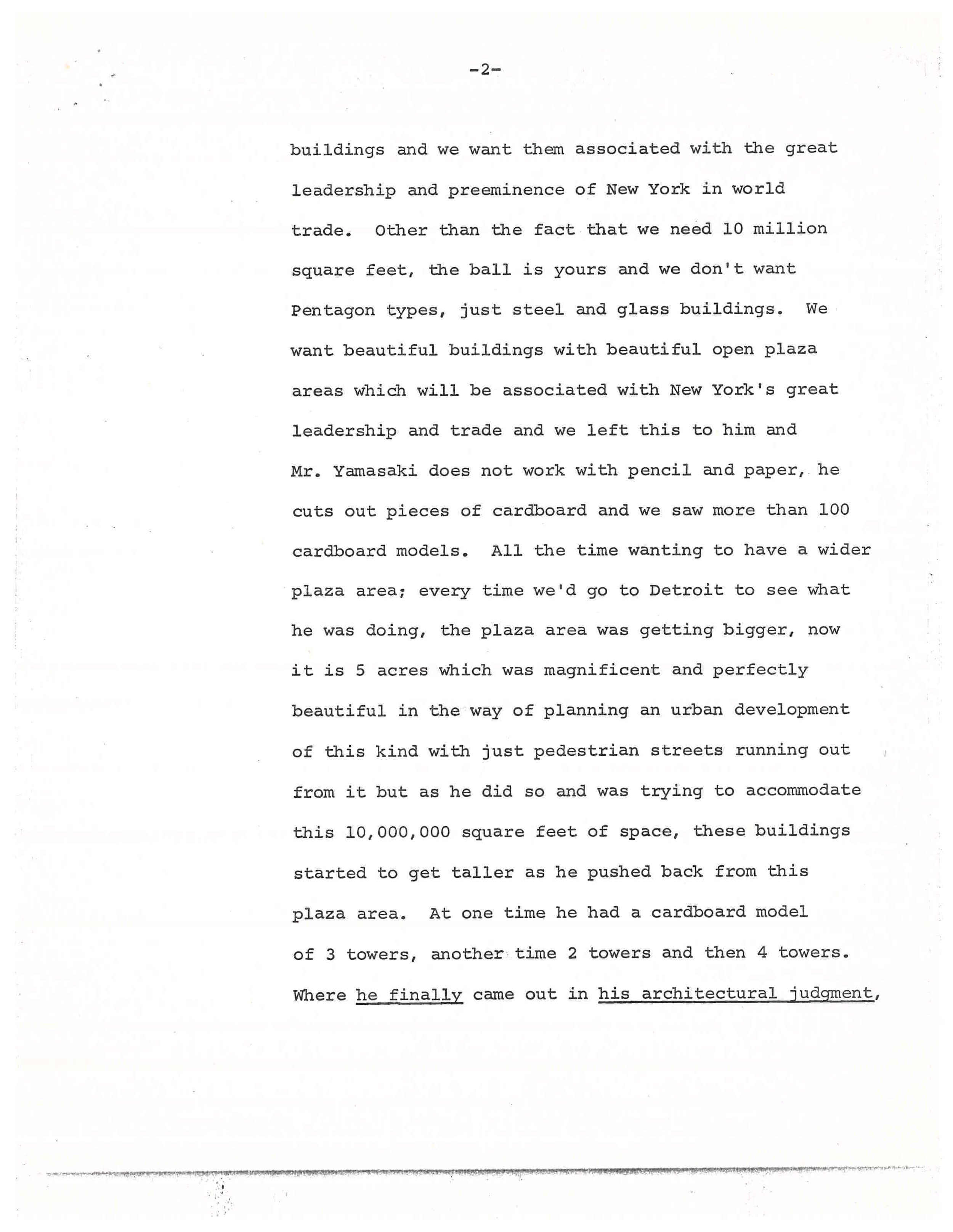
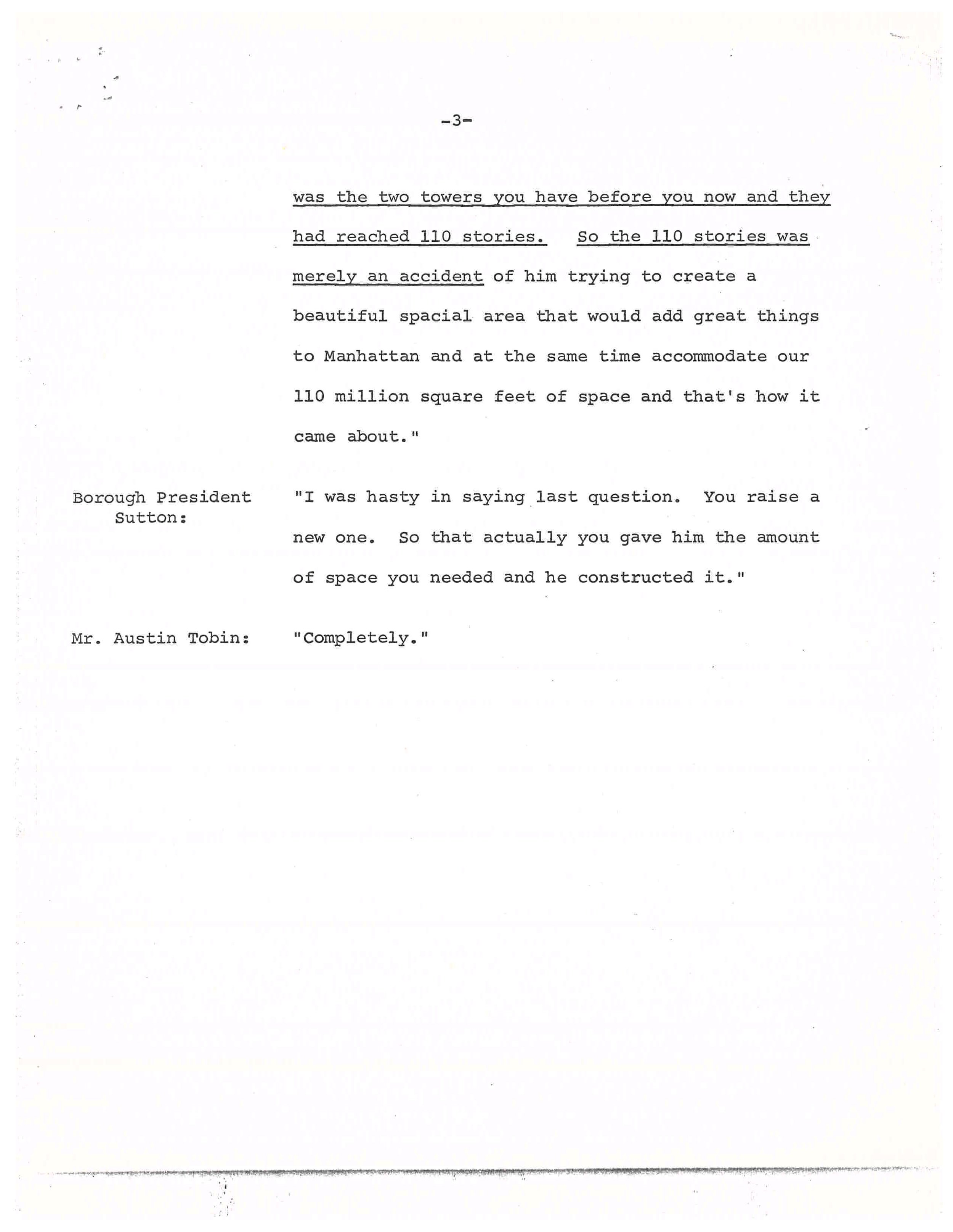
Excerpt from Manhattan Borough President Percy Sutton questioning Port Authority director Austin Tobin, Board of Estimate Hearing, June 16, 1967. Mayor Lindsey Collection, NYC Municipal Archives.
Harper’s Magazine, “New York’s Trade Center: World’s Tallest Fiasco,” advance proof of May 1966 edition. Mayor Lindsey Collection, NYC Municipal Archives.

Destruction of Radio Row, looking south along Greenwich Street from number 189, ca. April 1966. Jean M. Brown photographer, NYC Municipal Archives Collection.

The Port Authority offered Radio Row merchants $3,000 to relocate, and some did move—dispersing to Canal Street, Union Square and west of Times Square—but many refused the payments and simply went out of business. Eventually the project was pushed through, and by May of 1966 the architecture critic for Harper’s Magazine, Wolf von Eckardt, lamented “It’s ready to go up right now. How did the plans get this far?” He said the proposed “instrument of urbicide… not only the tallest, but unquestionably one of the ugliest buildings in the world,” would displace “thirteen historic, living and breathing square blocks of the city.”[1]

One resident of those thirteen blocks was Jean M. Brown, a young woman living at 189 Greenwich Street and working as a typist. She had a front row seat to the destruction of Radio Row and, using an amateur camera, she documented it from her 3rd floor window. Brown also took a photo of her own building before she too was evicted by the Port Authority in November of 1966, while seven-months pregnant. Brown just passed away in August 2023, but her son William recently recalled that she sent eleven photos to the Municipal Archives in 2005 because she wanted someone to remember what had once been a thriving neighborhood. In her donation letter she wrote, “I hope that this will be of help to future individuals who are interested in what that part of Manhattan looked like before the Trade Center was erected.”

Jean M. Brown lived on the 3rd floor of 189 Greenwich Street, above Adson Radio, until she was evicted in November 1966. Jean M. Brown photographer, NYC Municipal Archives Collection.

Super Radio Outlet, 65-67 Dey Street, ca. 1939. This address would later betaken over by Leotone Radio (see photo below). Tax Photograph Collection, NYC Municipal Archives.

61 Dey Street (far left) to 71 Dey Street with Washington Street and Pier 13 beyond, looking west from 189 Greenwich Street, June 1964. Jean M. Brown photographer, NYC Municipal Archives Collection.

Dismantling of Pier 13, Dey Street, looking west from 189 Greenwich Street, ca. April 1966. Jean M. Brown photographer, NYC Municipal Archives Collection.

Workers demolishing 65-67 Dey Street, looking west from 189 Greenwich Street, late summer or fall of 1966. Jean M. Brown photographer, NYC Municipal Archives Collection.

Destruction of Radio Row, Dey Street, looking west from 189 Greenwich Street, ca. November 1966. The West Side Elevated Highway is clearly visible in the background. A section of it collapsed in December 1973 and it was eventually removed in 1989. Jean M. Brown photographer, NYC Municipal Archives Collection.


[1] “New York’s Trade Center World’s Tallest Fiasco,” Harper’s Magazine, May 1966.

Further reading:

http://tribecatrib.com/content/world-trade-center-long-lost-world-radio-row

http://www.antiqueradio.com/Radio_Row_09-98.html

https://www.qcwa.org/radio-row.htm

The Playboy Plot

As an intern at the Municipal Archives this fall, it has been my privilege to help process the NYPD Intelligence Records, aka the Handschu collection. Very large—more than 520 cubic feet—and in high demand, this collection is made up of records created by a unit of the New York Police Department Intelligence Division, the Bureau of Special Services, which had the goal of monitoring “subversives.”

Playboy Magazine, January 1967. NYPD Intelligence Records, NYC Municipal Archives.

The material now held by the Archives is the result of decades’ worth of NYPD surveillance and investigation of both groups and individuals. This material spans the 1930s–1990s but is concentrated in the 1950s–1970s, and is divided into several series: for instance, Series 1.1 is for photographic records, while Series 1.4 and 1.5 are dedicated to small and large organizations respectively. Most of my hands-on work involved Series 1.2: Numbered Communications Files, which are thousands of reports created between 1951 and 1972. The reports are eclectic in their subject matter but tend to coalesce around topics like demonstrations, labor disputes, and security for public figures. The amount of material in the folders ranges from a single sheet to multiple brochures and clippings.

While processing these files, I recently came across a manila envelope with the arresting inscription: “Alleged plot by Cuban Nationalist Assoc. to fire bazooka at N.Y. Playboy Club.”

NYPD Intelligence Records, NYC Municipal Archives.

Both pro- and anti-Castro activities are widely represented in the collection, but this particular case merited a closer look. Why the Playboy Club? And why a bazooka? Reading the enclosed Bureau of Special Services report, it became clear that despite their alleged target, the Cuban Nationalists Association’s grievance was actually with Playboy magazine. I also found that there had been previous terrorist incidents involving anti-Castro Cubans and bazookas.

The numbered BSS report is dated November 25, 1966, and has the subject line “Information that anti-Castro Cubans have discussed planting of a live bazooka shell at the Playboy Club, 5 East 59th Street, Manhattan.” Passing on information received by an FBI agent from an unknown source, it discloses: “The Cubans are allegedly angry with the Playboy management because of an article written in the October issue of Playboy magazine titled ‘Tropic of Cuba,’ by Pietro di Donato, in which the author described prostitution and homosexual circuses in Havana in 1939. They consider the article vicious and dirty and apparently are not satisfied with the apology tendered by the magazine.” Because the Cuban Nationalist Association had been tied to previous explosions between 1964 and 1966, the agent felt that this intelligence could not “be discounted.” This opinion may or may not be counterbalanced by the fact that interviews with group members led to statements like “the organization is currently disorganized and has no meeting place,” and also that a subsequent FBI report describes the information as coming from “a source, contact with whom has been insufficient to determine his reliability.”

NYPD Intelligence Records, NYC Municipal Archives.

NYPD Intelligence Records, NYC Municipal Archives.

NYPD Intelligence Records, NYC Municipal Archives.

Along with the bombing of a Cuban ship, the bombing of Karl Marx’s grave, and the detonation of a bazooka in a suitcase at the Cuban Embassy in Canada, the Cuban Nationalist Association had been connected with the firing of a bazooka at the United Nations during an address by Che Guevara on December 11, 1964. The event was covered in the New York Times in articles such as “Bazooka Fired at U.N. as Cuban Speaks; Launched in Queens, Missile Explodes in East River,” “Three Castro Foes Arrested in Firing Of Bazooka at U.N.” and “Bazooka hearing is set for Jan. 6; 3 Cuban Suspects Called ‘Cooperative’ in Court.”

The first article reports: “A single shell from the bazooka, a portable rocket launcher used by the Army, arced across the river from Queens and fell harmlessly about 200 yards from shore. The blast sent up a geyser of water and rattled windows in the headquarters just as Major Guevara, Havana’s Minister of Industry, was denouncing the United States. [...] Later, strolling through the delegates’ lounge in his green fatigue uniform and highly polished black boots, he said, with a languid wave of his cigar, that the explosion ‘has given the whole thing more flavor.’ But the police saw no humor in the incident. Had the rocket shell crashed against the glass-and‐concrete facade of the headquarters building, there would almost certainly have been casualties.” The weapon was identified as U.S. made. The “three Castro foes” of the second headline were members of the Cuban Nationalist Association, although the director of the group claimed to have no knowledge of the events. At their hearing, “Assistant District Attorney Edward N. Herman told the court, ‘Regardless of where one’s sympathies may lie…the United Nations is here in the City of New York, our guests if you will, and they have the right, I think, not to have bazookas fired at them.’”

FBI Report, December 5, 1966. NYPD Intelligence Records, NYC Municipal Archives.
FBI Report, NYPD Intelligence Records, NYC Municipal Archives.

FBI Report, NYPD Intelligence Records, NYC Municipal Archives.

Also included in the manila envelope were two pieces from the newspaper El Tiempo. The first was a Spanish-language article condemning Playboy, dated October 25, 1966 and entitled “Una Infamia de ‘Playboy’: ‘El Trópico de Cuba’” (English: “A Disgrace from ‘Playboy’: ‘Tropic of Cuba.’”

El Tiempo, October 25, 1966. NYPD Intelligence Records, NYC Municipal Archives.
El Tiempo, 1966. NYPD Intelligence Records, NYC Municipal Archives.
The second was a photocopy of an undated English-language article entitled “The Playboy Incident.” “No one sympathizes more with the anti-Castro Cubans than EL TIEMPO,” it begins. “In fact, many now in the picket lines against Castro, were in 1959 picketing the editor of EL TIEMPO at his home and his office, because he said Fidel Castro was a Communist and deserved no support from this country.” Having established the publication’s bona fides, it continues, “But we cannot understand the fanatics who get out of hand, who make use of an article in EL TIEMPO to commit crimes and wreak violence.”  The article makes the points––not in this order––that the Playboy Club is a separate entity from the magazine, that the author of the offending article and the editor of Playboy had already both issued a public apology, and that “on careful reading, not one of the women with whom [the author] claims to have been intimate were Cuban. They were all foreigners living in Cuba.” Finally, the author exposes and repudiates the (alleged) plan to attack the club: “What the public did not know––and what we are revealing here for the first time is a result of the insidious rumours to the effect that EL TIEMPO, ‘sold out’ to the Playboy magazine: some hot-headed Cubans were planning to set off a bomb at the Playboy Club––which could have cost many innocent lives, including anti-Castro Cuban employees of the club itself.”

Playboy memo, December 6, 1966. NYPD Intelligence Records, NYC Municipal Archives.

NYPD Intelligence Records, NYC Municipal Archives.

Anticipating more controversy ahead of the publication of an interview with Fidel Castro in the January 1967 issue, Playboy Club co-owner Arnold Morton sent out a memo on December 6 in which he reminded his staff of the journalistic context behind this and other controversial interviews (“If you read Playboy regularly, I am sure you are aware of the wide range of personalities and subjects it deals with in each issue”) and rallies them to a defense of the brand’s core values (“This Castro interview may meet with strong reaction too, but Playboy Magazine has always believed in the right of groups or individuals to disagree. It is for this reason that the magazine often serves as a forum for persons and viewpoints that would otherwise never be published in a mass magazine”). With respect to the original “Tropic of Cuba” controversy, he quotes an apology from the article’s writer Pietro Di Donato: “At no point was it my intention to insult or defame the wonderful people of Cuba. As a man of 100% Latin origin, I have long been sympathetic with the plight of the Cuban people.” It should be noted however that this pan-Latin camaraderie was not shared by the author of the critical El Tiempo article, Miguel Angel Martin, who refers to Di Donato throughout as an “‘escritor’ ítalo-americano” (“Italian-American ‘writer’”).

In addition to the above typewritten reports and periodicals, the folder created by the Bureau of Special Services held a piece of paper covered in handwritten notes relating to the investigation. The sheet includes phrases like “Lee Lockwood, author of article, works with Cuban Mission,” the names of the Puerto Rican independence activist Juan Brás and El Tiempo editor Stanley Ross connected by arrows to the word “fight,” and my favorite, if I am reading it correctly: “4 plans to dynamite––none came off.”

Drives, Rides, and Walks—Horses in Central Park

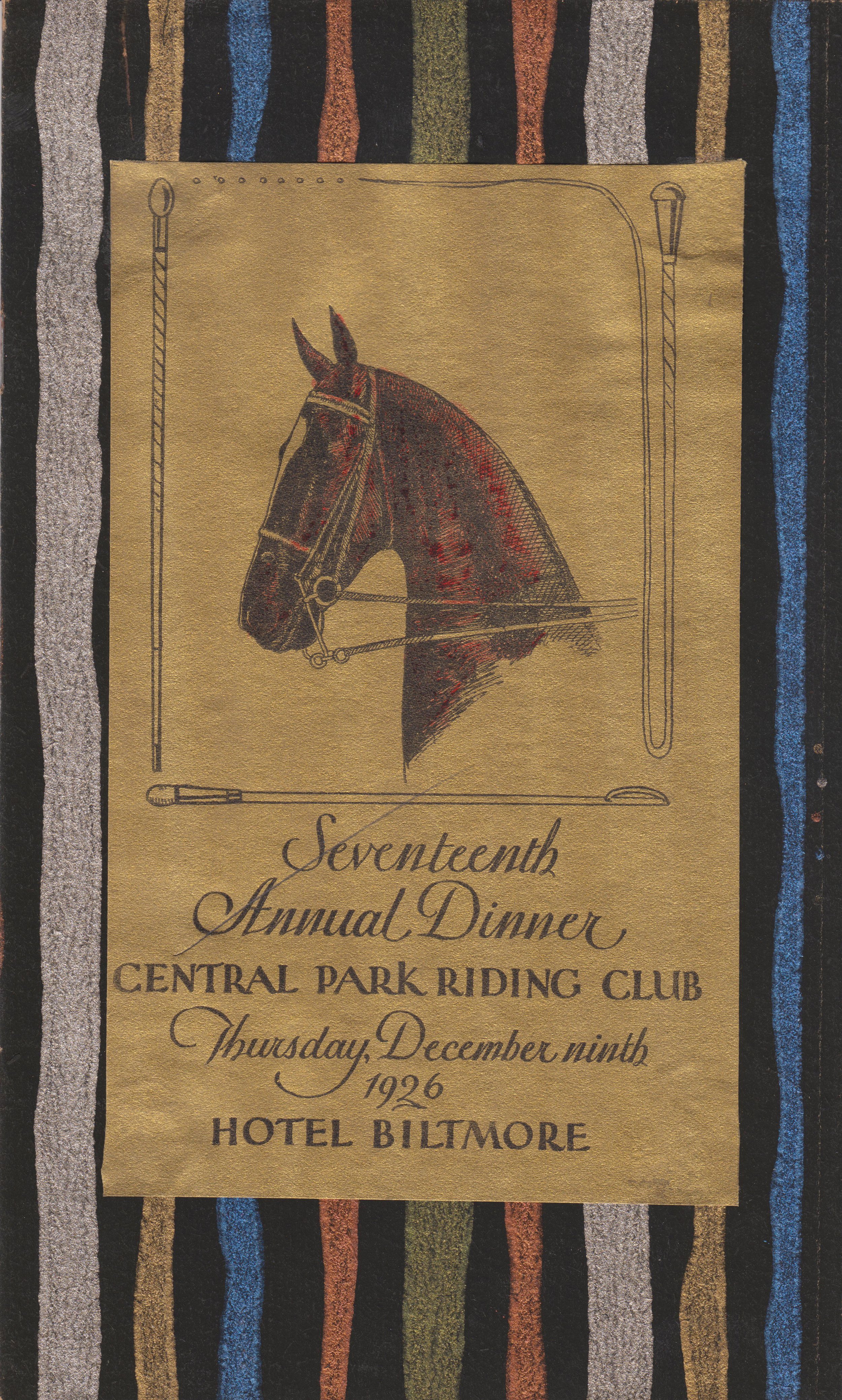
Central Park Riding Club dinner invitation, 1926. Office of the Mayor, Jimmy Walker, NYC Municipal Archives.

For more than one hundred fifty years visitors to New York’s Central Park have enjoyed picturesque vistas, rolling meadows, peaceful lakes, and a variety of charming architectural features.

Until recently, these pastoral scenes would have also included horseback riders cantering along the bridle paths. But after closure of the Claremont Riding Stables, located on Manhattan’s Upper West Side, in 2007, the horseback riders have largely vanished. Today—except for the southernmost area of the park where horse-drawn carriages still ply the roadway—horses are almost completely absent from the landscape.      

A recent For the Record blog, Horsepower: The City and the Horse introduced the topic of the horse and its profound influence on virtually all aspects of city life. This week’s article looks at how the horse informed many of the design elements of Central Park.

Central Park, shelter for carriages and horses, preliminary study, front elevation, 1871. Jacob Wrey Mould, Architect. Department of Parks Collection, NYC Municipal Archives.


Drives, Rides, and Walks

One of the most innovative features of Frederick Law Olmsted and Calvert Vaux’ design for the park was their traffic circulation system that separated walkers, horseback riders, and horse-drawn carriages, creating intimate landscapes for each type of traveler.   

The Drives were wide and sweeping, avoiding sharp turns to allow passengers in horse-drawn carriages to focus on the landscape. Park gardener Ignatz Pilat described the careful planning that went into their landscaping:       

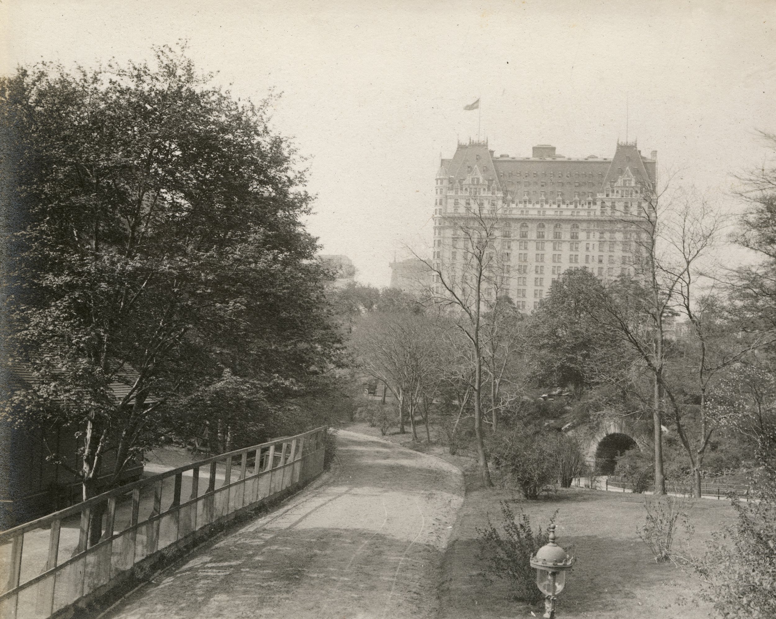
Central Park, Bridle Road Looking South, ca. 1913. Albert W. Schaad, photographer. NYC Municipal Archives collection. Schaad was a Central Park Zookeeper who created a scrapbook of his photos.

“The effect already produced and to be perfected in the course of time, throughout the length of the ‘Ride,’ is that of a pleasant country-road shaded by over-arching trees, mingled with shrubs and vines, spaces being left for more or less expanding views of open lawns, sheets of water, and other objects of interest which give the idea of extent and diversity; but wherever these open spaces would destroy the harmony of the landscape, a few scattered trees or low shrubs are so arranged as not to obstruct the view.”

The Rides, or bridle trails, generally hugged the perimeter of the park. For pedestrians, the Walks meandered through valleys, providing glimpses of the elegant carriage traffic nearby. All routes were surfaced and drained for safe passage in all types of weather. Where arteries met, the over- and underpasses of bridges were used as much as possible to separate carriage and horse traffic from pedestrians.     

Central Park, Entrances and Gates, Entrance at 90th Street and Fifth Avenue, plan of entrance and section of adjoining wall, 1865. William H. Grant, engineer. Department of Parks Collection, NYC Municipal Archives.

Another prescient feature of Olmsted and Vaux’ design for the park, also conceived to accommodate the horse, specifically horse-drawn vehicles, were the transverse roads. The original design competition specified that each submission must include at least “four or more crossing from east to west be made between Fifty-ninth and One Hundred and Sixth Street.” Olmsted and Vaux’ ingenious scheme was to sink the roads below grade. This made it possible to keep park visitors safely above the crosstown traffic, colorfully portrayed in their proposal as “coal carts and butchers’ carts, dust carts, dung carts” and “fire companies rushing their machines with fantastic zeal at every alarm.”    


Winterdale Arch (Bridge No. 17)  

Winterdale Arch, located along the West Drive near Eighty-Second Street, is named for its location on the Winter Drive, between Seventy-Second Street and 102nd Street. When planning the west side of the park, Olmsted and Vaux intended for this section to be planted with a variety of evergreens, to add color throughout the winter for carriage- and sleigh-riders. 

Central Park, Bridge number 17 [Winterdale Arch], elevation of bridge and railing, 1861. Department of Parks Collection, NYC Municipal Archives.


Stables and Workshops 

After years of maintaining offices at Mount St. Vincent and the Arsenal, in 1869 the Central Park Board of Commissioners decided to construct “offices of Park administration” at a location that would be more easily accessible from all points in the park. The site proposed was at the northern edge of the old Yorkville Receiving Reservoir, on a sliver of land at a curve in Transverse Road No. 3, now called the Eighty-Sixth Street Transverse. The new offices would have included “engineering, architectural, and gardening apartments,” a stable with storage sheds for vehicles and machinery, and a separate building to house blacksmiths, carpenters, and other craftspeople.      

Central Park, Offices of Administration, North Wing - East End, Details of Stable Building, Keeper’s Dwelling, etc. south front and west side elevations and longitudinal sections, 1869. Attributed to Jacob Wrey Mould, Architect. Department of Parks Collection, NYC Municipal Archives.

Central Park, Offices of Administration, North Wing - East End, Details of Stable Building, Keeper’s Dwelling, etc. [detail], 1869. Jacob Wrey Mould, Architect. Department of Parks Collection, NYC Municipal Archives.

Central Park, Offices of Administration, General Ground Plan of East End of North Wing, showing stable, sheds, yard and keeper's dwelling [detail], 1869. Attributed to Jacob Wrey Mould, Architect. Department of Parks Collection, NYC Municipal Archives.


Mount St. Vincent/McGown’s Pass Tavern

In the latter part of the nineteenth century, a favorite stop for park visitors was the Mount St. Vincent Hotel. Built in 1881, it proved to be immediately popular with affluent New Yorkers, as the New York Times reported in 1886: “No matter how fast the team nor how elegant the equipage a turn ‘on the road’ is not done in proper shape unless it includes a bite or a sip in the Mount St. Vincent.  

The Hotel was located in the quiet and rustic northeastern corner of the park, a landscape filled with steep bluffs and rough terrain. The old Boston Post Road—the original mail-delivery route from New York City to Boston—meandered between two rocky ridges in this area, and in the 1750s John Dyckman built a tavern to serve travelers in the vicinity of 105th Street and Fifth Avenue. Not long after, the McGown family purchased the land and tavern, running it successfully through the Revolutionary War. Hence the name of the small valley: McGown’s Pass.      

Central Park, Mount Saint Vincent, design for a refreshment house, front elevation and side elevations, 1883. Julius F. Munckwitz, Architect. Department of Parks Collection, NYC Municipal Archives.

The McGowns held the property until 1845, when they deeded the land and buildings to the Sisters of Charity of St. Vincent de Paul, who renamed the area Mount St. Vincent’s. Within a few years, the nuns had established a convent and school. To the existing structures, they added a two-story residence for the chaplain and a stately brick convent house that contained a beautiful chapel and large dining rooms. In 1856, before the nuns had consecrated their new chapel, they received word that the city would be taking their land for the creation of the new park.

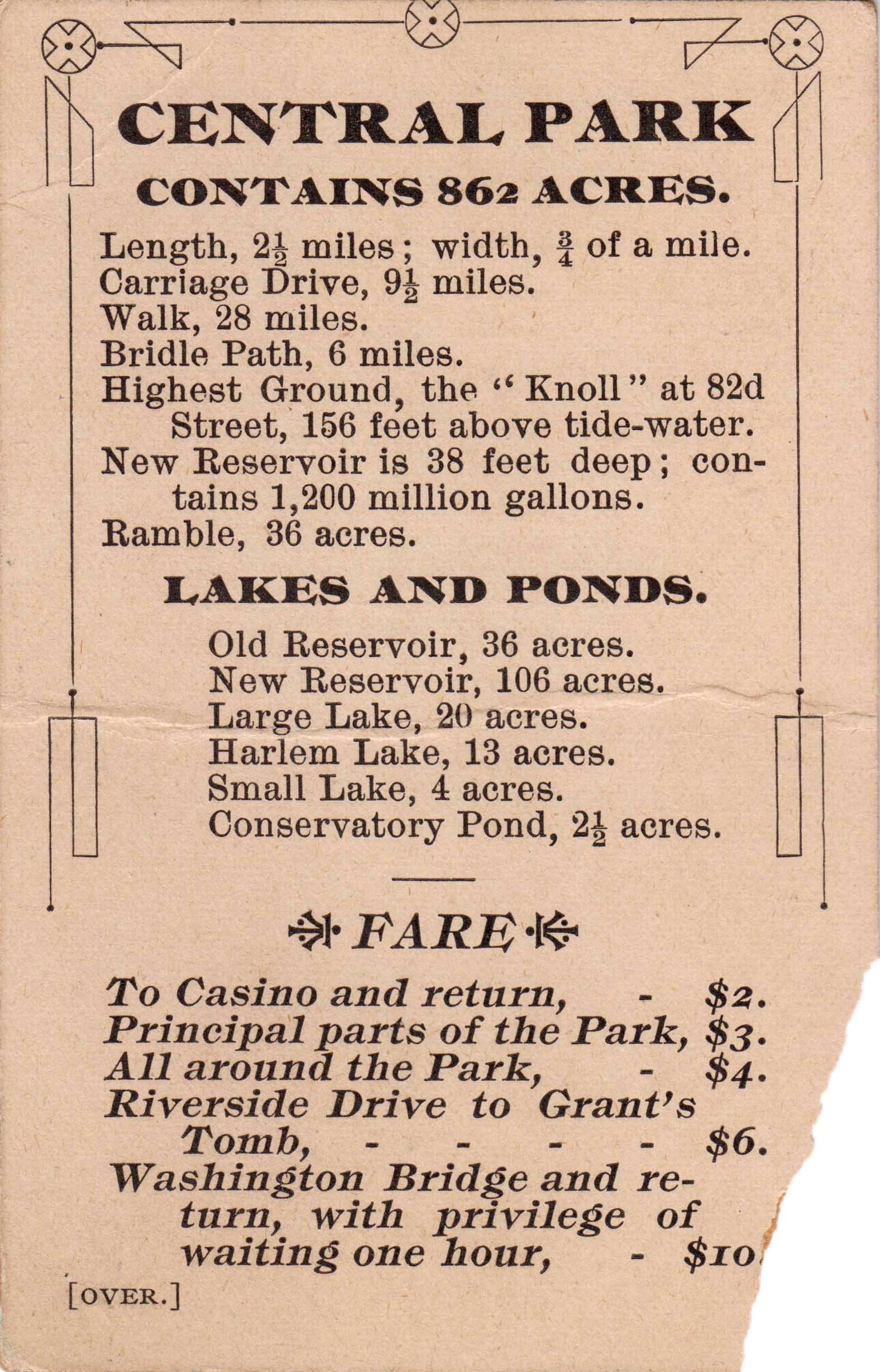
Central Park carriage ride card, n.d. Mayor James Walker collection. NYC Municipal Archives.

Central Park carriage ride card, n.d. Office of the Mayor, Jimmy Walker, NYC Municipal Archives.

Now owned by the city, the buildings became the park headquarters, and at one point the families of both Olmsted and Vaux lived at the site. With the outbreak of the Civil War, the US government took over the complex for use as a hospital for wounded soldiers who were, curiously enough, tended by the same Sisters of Charity who had previously owned the buildings!

Once it became known as a playground for drinking and dancing for the city’s elite, the Sisters of Charity asked that their name no longer be associated with the establishment. Renamed for the family most associated with the site, McGown’s Pass Tavern remained in operation until 1915, when its contents were put up for auction and the building torn down.   


Drinking Fountains for Horses 

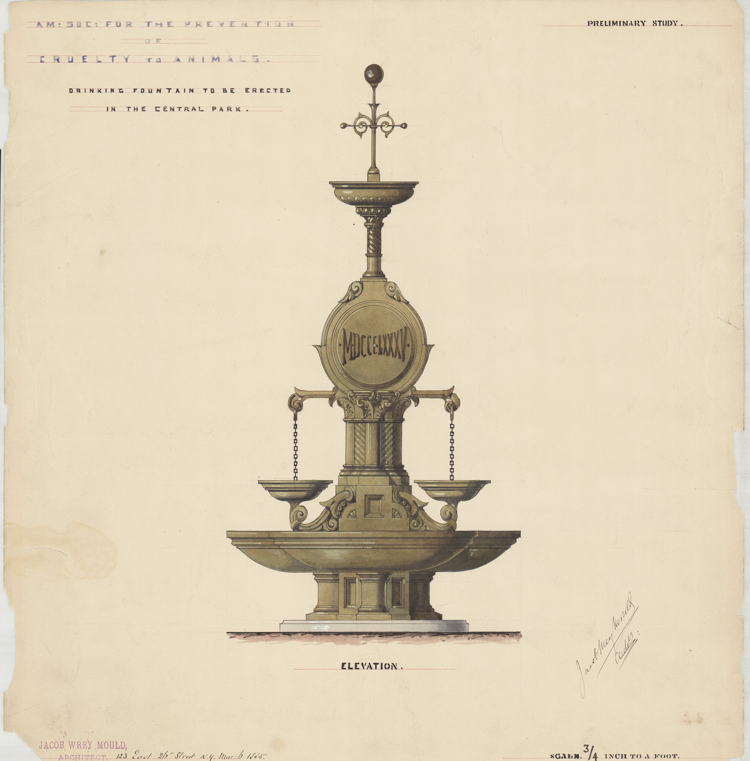
Overlooking the Lake and just west of Bethesda Terrace is the peaceful area known as Cherry Hill, named for its spring-blooming cherry trees. The paved concourse on the crest of the hill was originally intended as a scenic turnaround for horse-drawn carriages, in the center of which was a stunning fountain for watering horses. Designed by Jacob Wrey Mould in 1867, it was constructed of polished granite, wrought iron and bronze, and decorative Minton tiles, with eight colorful porcelain saucers for birds to drink from.    

Central Park, Drinking fountain for horses, southwest concourse, details of bronze finial and lamp, elevation, 1871. Jacob Wrey Mould, Architect. Department of Parks Collection, NYC Municipal Archives.

Central Park, Drinking fountain for horses, southwest circle, details of bronze arm and porcelain saucer, 1871. Jacob Wrey Mould, Architect. Department of Parks Collection, NYC Municipal Archives.

American Society for the Prevention of Cruelty to Animals: Drinking fountain to be erected in Central Park, elevation, 1885. Jacob Wrey Mould, Architect. Department of Parks Collection, NYC Municipal Archives.


The illustrations in this article, and more than 250 others, such as the original winning competition entry submitted by Olmsted and Vaux, meticulously detailed plans and elevations of many of the architectural features of the park, as well as intricate engineering drawings are included in “The Central Park: Original Designs for New York’s Greatest Treasure.” It is available at bookstores throughout the city and through on-line retailers.  

Remembering Rosalynn Carter

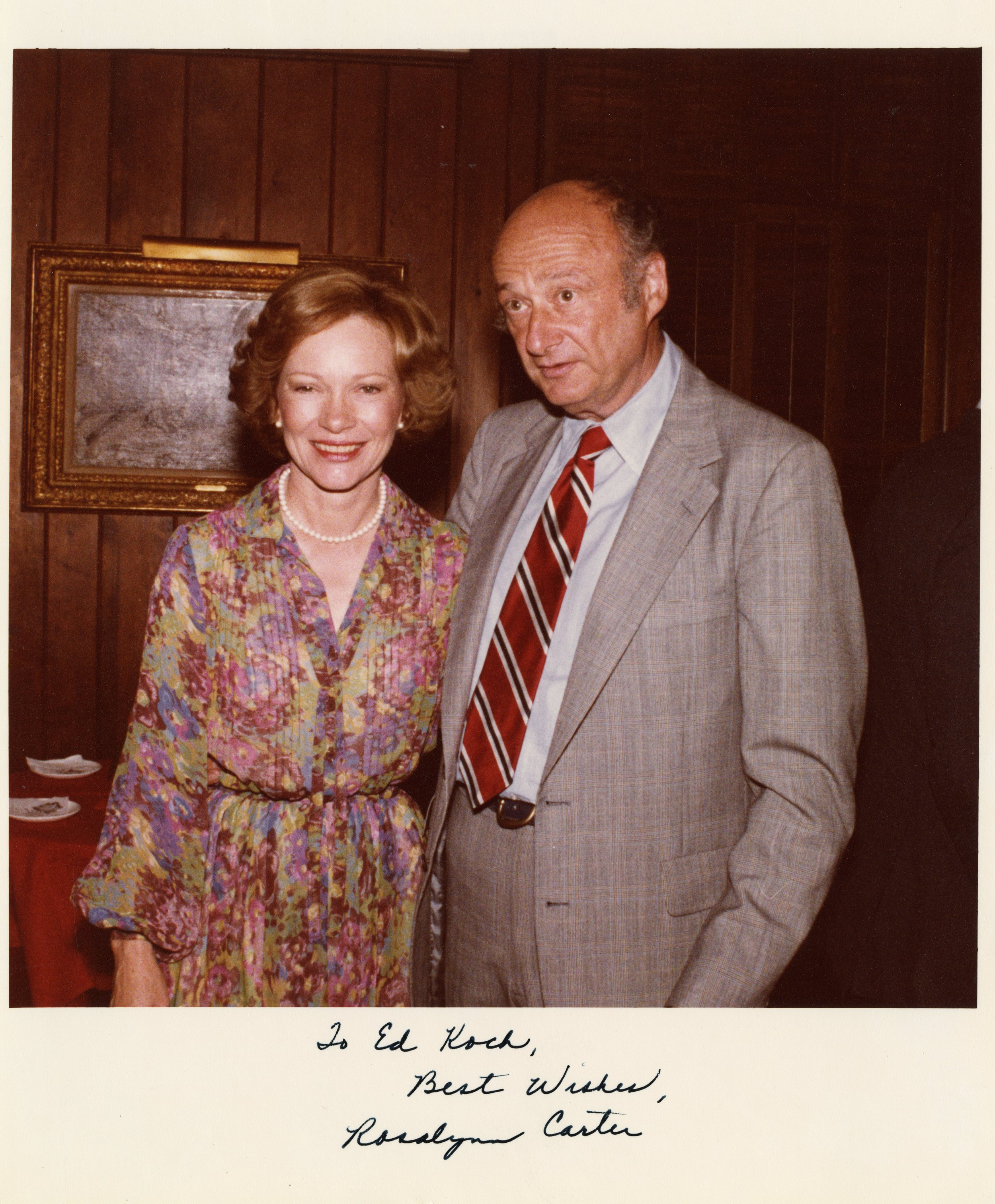
Mayor Edward I. Koch with First Lady Rosalynn Carter, 1979. Mayor Edward I. Koch collection, NYC Municipal Archives.

Following her death on November 19, 2023, many news stories, obituaries, and reminiscences about former first lady Rosalynn Carter remarked on her exceptional role as confidant and advisor to Jimmy Carter throughout their more than seven decades of married life. “Serving as an equal partner to her husband, the president,” wrote New York Times reporter Azadeh Moaveni, “. . . she frequently attended Mr. Carter’s cabinet meetings and traveled abroad to meet with heads of state in visits labeled substantive, not ceremonial. She often sat in on the daily National Security Council briefings held for the President and senior staff.” [“Before Hillary Clinton, There Was Rosalynn Carter.” November 21, 2023.] Given her important role it should not be a surprise that there are photographs of Rosalynn Carter in the Mayor Koch photograph collection in the Municipal Archives.   

(L-R) First Lady Rosalynn Carter, New York State Governor Hugh Carey, President Jimmy Carter, Mayor Edward I. Koch, Senator Daniel Patrick Moynihan, House Speaker Tip O’Neil, Treasury Secretary W. Michael Blumenthal, and Representative Mario Biaggi, August 8, 1978. Mayor Edward I. Koch photograph collection, NYC Municipal Archives. 

On a hot summer day, President Jimmy and First Lady Rosalynn Carter stood before a cheering crowd in front of City Hall after a bill-signing ceremony that gave New York City $1.65 billion in Federal loan guarantees as part of the effort to avoid bankruptcy. The Times story reporting on the event noted that “Mr. Carter signed the measure on a mahogany desk that had been used by George Washington when he was President, and as Mr. Carter pointed out, New York was the nation’s capital and Washington was a swamp.” [“Carter Signs Aid Bill for New York at Gala Celebration at City Hall,” August 9, 1978.] 

(Left to Right) Maureen Connelly (Press Secretary to Mayor Koch), President Jimmy Carter, First Lady Rosalynn Carter, and Mayor Edward I. Koch, Washington, D.C., June 1979. Mayor Edward I. Koch collection, NYC Municipal Archives.

Letter to Mayor Koch from Jack H. Watson, Jr., at the time, Assistant to the President for Intergovernmental Affairs, but who would become White House Chief of Staff to President Carter, August 14, 1979. Mayor Edward I. Koch Collection, NYC Municipal Archives.

Joan Mondale, Vice President Walter Mondale, President Jimmy Carter, First Lady Rosalynn Carter, Amy Carter, and Senator Ted Kennedy, on the stage at the Democratic National Convention, Madison Square Garden, New York City, August 1980. Mayor Edward I. Koch photograph collection, NYC Municipal Archives. 

Smiling faces on the dais belie drama behind the scenes. Earlier that summer, Mayor Koch’s request for additional federal support from the Carter Administration had not achieved the desired result. The President’s attempt to rescue the fifty-two Americans held hostage in Iran had stalled, and Senator Ted Kennedy’s presidential-run threatened to upend the convention. In the end, Carter prevailed, won the nomination, but lost to Ronald Reagan in the general election.  

Correspondence, Jimmy Carter to Mayor Edward I. Koch, May 16, 1984 on behalf of Habitat for Humanity, regarding a building at 742-44 East 6th Street. Mayor Edward I. Koch Collection, NYC Municipal Archives.

Correspondence, Mayor Edward I. Koch to Jimmy Carter, June 18, 1984, regarding the building at 742-44 East 6th Street. Mayor Edward I. Koch Collection, NYC Municipal Archives.

Jimmy and Rosalynn Carter continued their close collaboration during their post-White House years. The Habitat for Humanity organization was one of their most enduring endeavors. In 1984, they wrote to Mayor Koch and asked for his assistance with their work to rehabilitate a building on the Lower East Side of Manhattan.

President Jimmy Carter with Commissioner Anthony Gliedman of HPD, at a Habitat for Humanity project at 742 East 6th Street, Manhattan, July 1985. Photographer Leonard Boykin, HPD Photograph Collection, NYC Municipal Archives.

Commissioner Anthony Gliedman of HPD, talking to Rosalynn Carter at a Habitat for Humanity project at 742 East 6th Street, Manhattan, July 1985. Photographer Leonard Boykin, HPD Photograph Collection, NYC Municipal Archives.